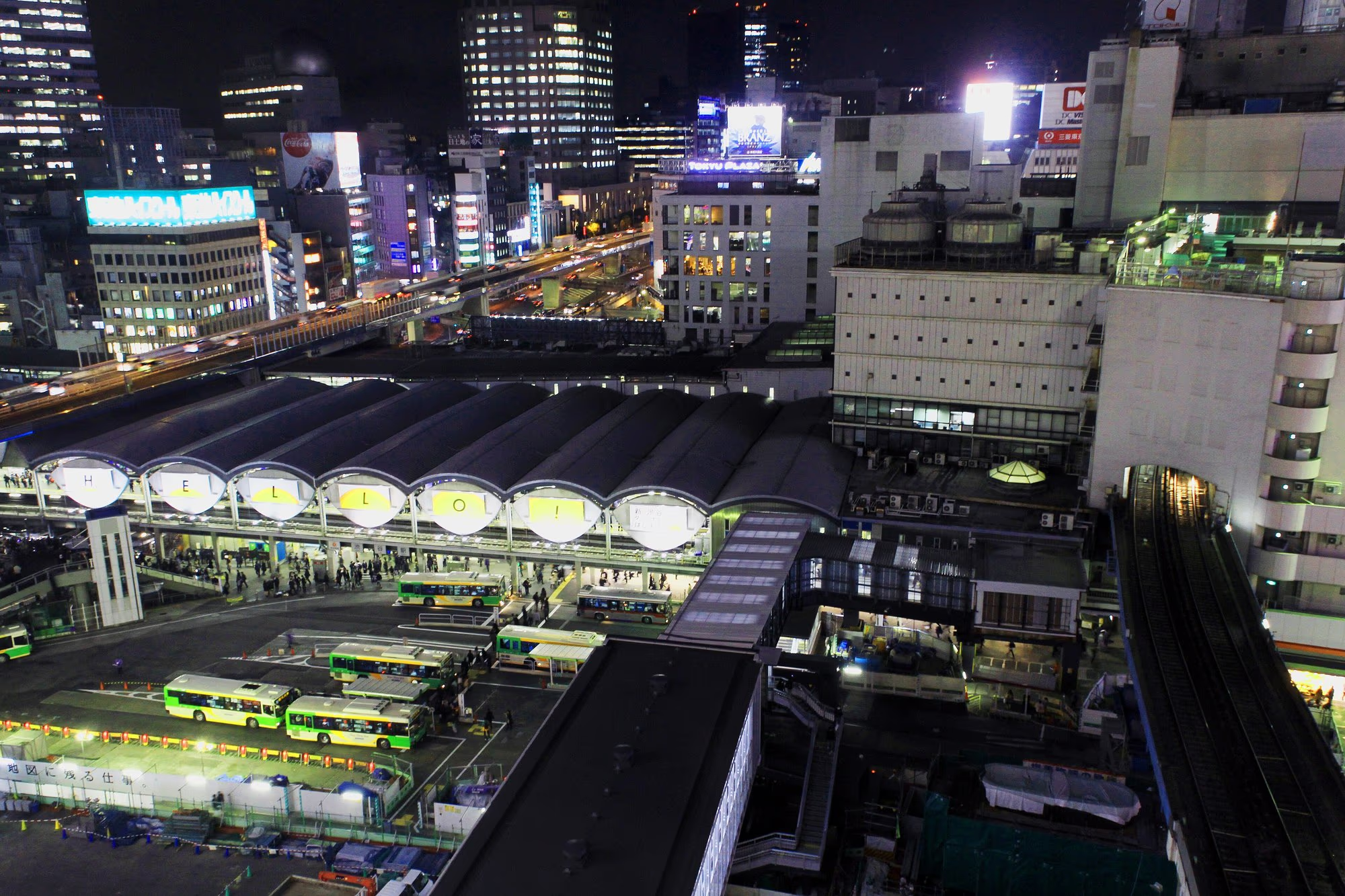
The first thing that tires you out in Shibuya is not the sightseeing. It is the station.
Eight lines cross here on levels running from deep underground to the fourth floor, and large-scale redevelopment keeps moving the passages. Understanding the shape of it saves a lot of pointless walking.
The lines
| Operator | Lines |
|---|---|
| JR East | Yamanote, Saikyō, Shōnan-Shinjuku |
| Tokyu | Tōyoko, Den-en-toshi |
| Keio | Inokashira |
| Tokyo Metro | Ginza, Hanzōmon, Fukutoshin |
Roughly where things are
- JR — ground level, the centre of the station
- Ginza line — third floor. Unusually high up
- Tōyoko and Fukutoshin — fifth basement level. The deepest
- Hanzōmon and Den-en-toshi — underground
- Inokashira — second floor, west side towards Mark City
The Tōyoko and Fukutoshin platforms are five levels below ground, and getting to the surface takes a while. Allow ten minutes from there to the Scramble Crossing on a first visit.
Which exit for where
This is the information that matters most. Correcting a wrong choice after the gates is awkward, so decide first.
| Destination | Exit |
|---|---|
| Scramble Crossing, Hachikō statue | Hachikō exit (JR) |
| Shibuya Sky, Shibuya Scramble Square | East exit / direct connection |
| Center-gai, SHIBUYA109 | Hachikō exit, then cross |
| Shibuya Parco, Pokémon Center | Hachikō exit, then 7 min north up Kōen-dōri |
| Miyashita Park | East or Hachikō exit, 5 min north-east |
| Shibuya Hikarie | East exit / direct connection |
| Nonbei Yokocho | Hachikō exit, 5 min north-east |
| Meiji Jingū | One JR stop to Harajuku, or 20 min on foot |
| Dōgenzaka, Maruyamachō | Hachikō exit, cross, head west |
When you are lost
Head for the Hachikō exit.
It is the only exit signed from every part of the station. Come out there and you are standing on a corner of the Scramble Crossing, which fixes your position. From there you can start again towards wherever you were going. It may cost you a detour, but you will not stay lost.
Map applications are often unreliable inside Shibuya Station — it is multi-level and GPS accuracy drops. Follow the physical signage.
From the airports
Haneda (35–50 minutes)
Three routes.
1. Tokyo Monorail + JR — Monorail to Hamamatsuchō, then the JR Yamanote line. One change.
2. Keikyu + JR — Keikyu to Shinagawa, then the Yamanote line. One change.
3. Direct bus — Limousine buses serve the Shibuya area. No changes, but subject to traffic.
With significant luggage, consider the bus. The trains involve stairs and interchanges, and given the shape of Shibuya Station, moving through it with cases is hard work.
Narita (80–110 minutes)
The Narita Express stops at Shibuya, which makes it the easiest option.
- No changes
- All seats reserved
- Space for large luggage
It costs more than the alternatives, but arriving without a transfer counts for a lot when you are carrying bags.
Other routes — the Skyliner to Nippori then JR, or a low-cost coach — all involve changes.
Luggage is a real constraint here
Shibuya Sky’s rules
- Large luggage such as suitcases cannot enter the building
- Hand luggage — bags, backpacks, pouches — cannot go onto the rooftop
- All of it goes into lockers on 46F
So going straight from the airport to the observation deck does not work.
Options
- Leave bags at your accommodation — many hotels hold luggage before check-in
- Use the coin lockers at Shibuya Station
- Use a luggage-holding service
Lockers fill at peak times, and large sizes go first. Secure one early, or prioritise your hotel.
Onward from Shibuya
| Destination | Time | Line |
|---|---|---|
| Harajuku | 2 min (1 stop) | JR Yamanote |
| Ebisu | 2 min (1 stop) | JR Yamanote |
| Shinjuku | 6 min (2 stops) | JR Yamanote |
| Tokyo Station | 25 min | JR Yamanote |
| Asakusa | 30 min | Tokyo Metro Ginza |
| Akihabara | 25 min | JR Yamanote |
| Roppongi | 15 min | Tokyo Metro, with a change |
Omotesandō is fifteen minutes on foot and Meiji Jingū about twenty. Neighbouring districts are covered in what’s near Shibuya.
Seeing the district at road level
Beyond walking and trains, an open-top double-decker bus runs routes around Shibuya, including a Shibuya–Shinjuku Kabukichō service, with multilingual audio.
It is more an experience than transport, but passing through the Scramble Crossing at road level is a perspective you get neither on foot nor from a deck.
About the hills
Shibuya is built on a slope. Dōgenzaka, Miyamasuzaka, Kōen-dōri, Spain-zaka. The name itself contains the character for valley: the station sits at the bottom and the land rises in every direction.
Distances that look short on a flat map can be uphill. Wear shoes you can walk in.
Ongoing construction
Redevelopment around Shibuya Station has been running for years and continues.
- Passages move
- Exits close temporarily
- App data and older guides can be out of date
Trust the signage in front of you. New notices go up with each phase of work.
Sources
Line information and exit names are based on the operators’ published material and on-site signage. Journey times are approximate and vary with the hour and service conditions.
For airport journey times and fares, consult the transport operators’ own sites. Shibuya Sky’s luggage rules come from the official Shibuya Scramble Square site, checked on 3 September 2026.
Redevelopment continues to change the station. Confirm details on site at the time of your visit.